
A Time-of-Flight (ToF) camera is an active depth camera. It illuminates a scene and estimates distance at many image locations, producing a depth map rather than only one range value. A depth map can help software locate surfaces, estimate dimensions, and plan interaction with objects. It is not, by itself, an object-recognition or safety system.
How does a ToF camera work?
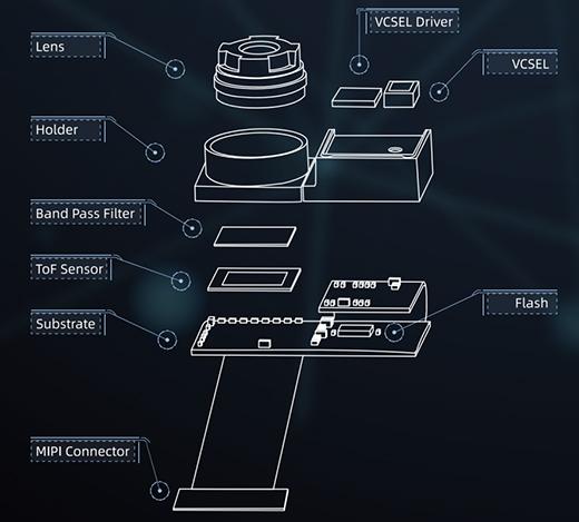
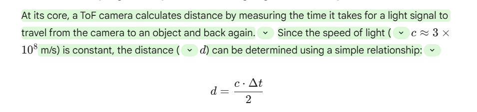
An emitter sends modulated or pulsed near-infrared light into the field of view. A receiver records returned light, and the camera estimates range using either direct flight-time measurements or phase delay. Each valid pixel or zone corresponds to a distance along the camera’s line of sight. A device may also report amplitude or confidence so software can reject weak or ambiguous returns.
ToF camera versus single-point ranging sensor
A single-point sensor can be sufficient for approach detection, fill level, or wall following. A camera captures spatial information across a scene, useful for identifying a parcel’s extent, estimating a robot’s free space, or counting movement through a defined area. Higher spatial resolution increases data volume and may change frame rate, power, and processing requirements.
Common uses and what each still requires
- Robotics and machine vision: depth supports localization, grasp candidates, and obstacle maps; a separate algorithm and validation determine whether a robot can act on them.
- AR and 3D reconstruction: measured geometry can improve placement and occlusion, but full models require multiple views, registration, and handling of missing surfaces.
- People counting: a depth camera can detect movement across a line or zone; accuracy depends on mounting, occlusion, crowd density, and the counting logic.
Limits to check before integration
Dark, highly reflective, translucent, or oblique targets may give low-confidence depth. Sunlight, other active optical devices, and a dirty protective window can reduce usable range. Evaluate the exact camera at the intended distance, field of view, illumination, and frame rate. Do not assume that all ToF cameras have the same outdoor performance or are unaffected by surface color and texture.
Reading and validating a depth image
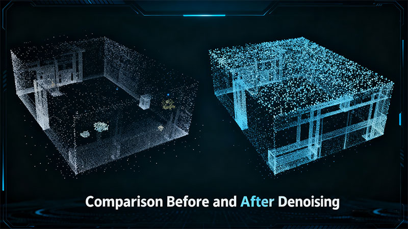
The output may include depth, amplitude, confidence, and invalid-pixel indicators. A displayed 3D point cloud is calculated from depth plus the camera’s intrinsics; it does not add measurements that the camera never observed. Check the coordinate convention, depth units, calibration status, and invalid values before comparing two cameras or using depth for control. A phone’s “3D sensor” label alone does not identify the underlying ToF architecture or prove that its depth output is available to applications.